The GSSC specializes in Acquiring, Archiving, Visualizing, Querying, and Disseminating scientific data and metadata holdings for researchers in the natural and social sciences.
This page highlights some of the data archives that we manage.
Contact us here for more information about how we can help you write a Data Management plan for an upcoming research proposal or how we can help you to manage your current scientific data holdings.
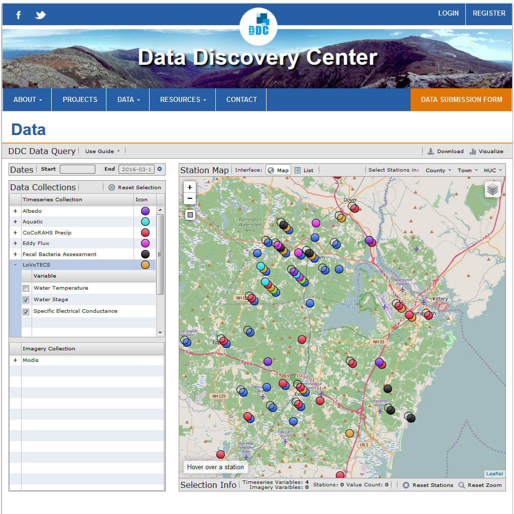
The Data Discovery Center (DDC) is a digital library that provides access to a broad suite of data sets generated by the Maine, Rhode Island, and New Hampshire EPSCoR programs. Current data holdings include atmospheric, aquatic, and terrestrial sensor data, imagery, model results, and survey data.
User tools include spatail and text based queries, modeling tools, and web mapping data visualizations.
Ask us about how we can implement a digital data library for your next porject or data archive.
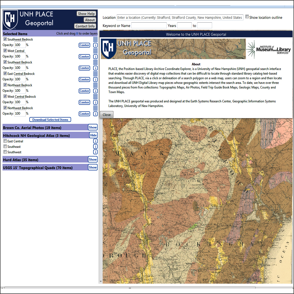
PLACE, the Position-based Library Archive Coordinate Explorer, is a UNH geospatial search interface that enables easier discovery of digital map collections that can be difficult to locate through standard library catalog text-based searching. Through PLACE, users can zoom to a region and then locate and download all UNH Digital Library map pieces whose geographic extents intersect a search area. To date, we have over 3000 pieces from five collections: Topographic Maps, Air Photos, Field Trip Guide Book Maps, Geologic Maps, County and Town Maps.
The UNH PLACE geoportal was designed and produced by the Geographic Information Systems Laboratory at the Earth Systems Research Center here at UNH.
Ask us about how we can implement a data explorer website for your next project of dataset.
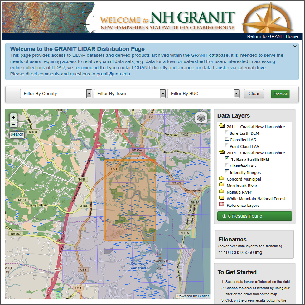
The NH GRANIT LiDAR Explore, is a UNH geospatial search interface that enables easier discovery LiDAR datasets and derived products archived within the NH GRANIT (Geographically Referenced Analysis Network Information Transfer System) database. Through NH GRANIT LiDAR Explorer interface, users can zoom to a region and then locate and download LiDAR data whose geographic extents intersect a search area, town, or watershed.
The NH GRANIT LiDAR Explore geoportal was designed and produced by the Geographic Information Systems Laboratory at the Earth Systems Research Center here at UNH.
Ask us about how we can implement a data explorer website for your next project of dataset.
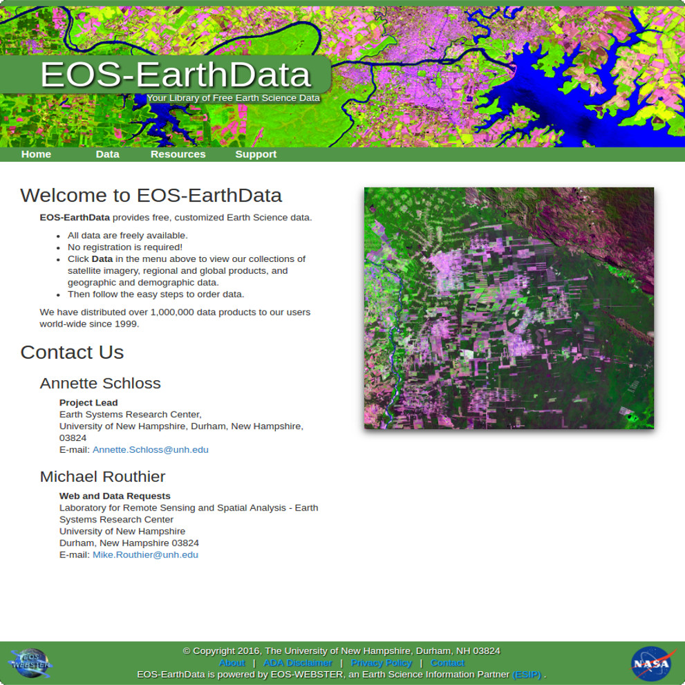
EOS-EarthData is a digital library serving the earth system science community. It is designed to provide single-source access to a rich selection of geographically based information including model output, satellite imagery, and vector data. All data is freely available, requires no registration, and is easily accessible through a simple point and click interface.
To date, we have distributed over 1,000,000 data products to our users world-wide since 1999.
To find out more about the EOS-EarthData Library please contact us here.
Ask us about how we can implement a digital data library for your next porject or data archive.
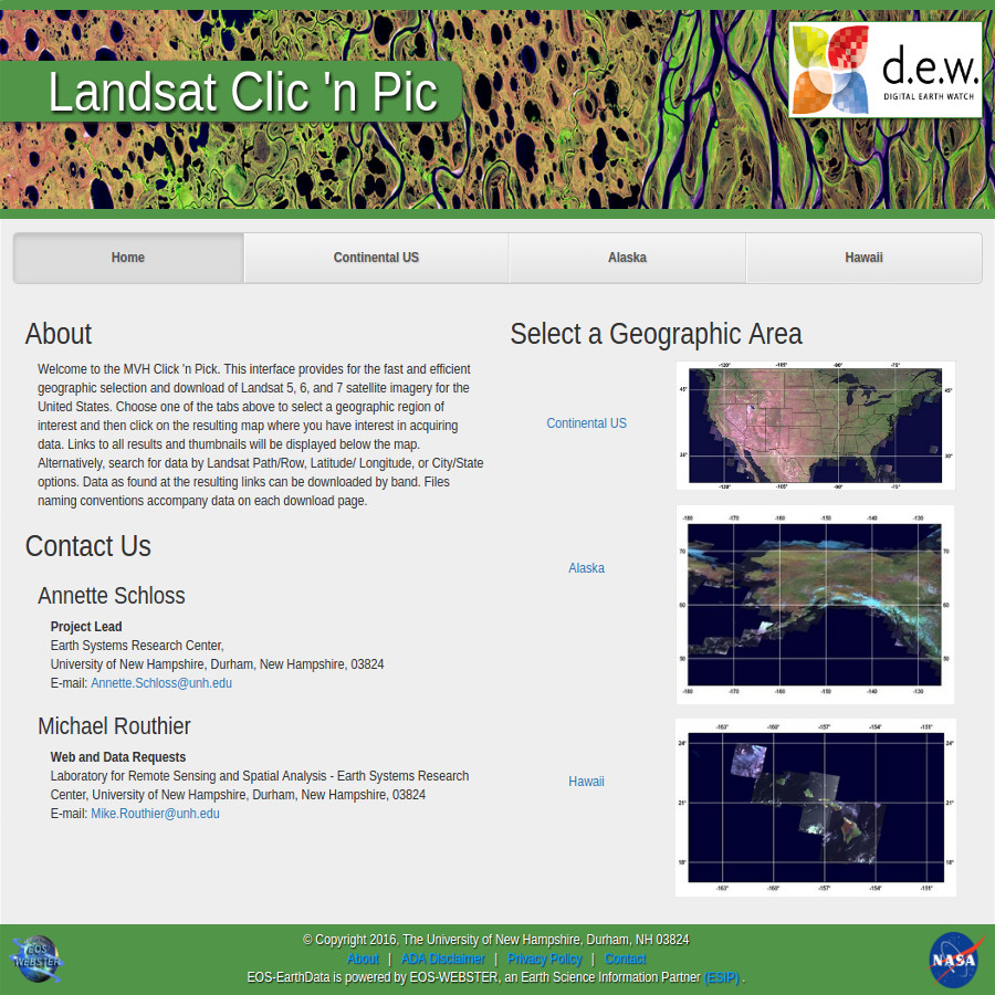
The MVH Clic 'n Pic is a web mapping data search interface that provides fast and efficient geographic selection and download of Landsat 5, 6, and 7 satellite imagery for the United States. Users can simply click on a map to acquire thumbnail listings of available data for their location of interest and then pick which data they would like to download. Satellite data is distributed by band and file naming conventions that accompany each file on their download page.
Click here to find out more about the MVH Landsat Clic 'n Pic.
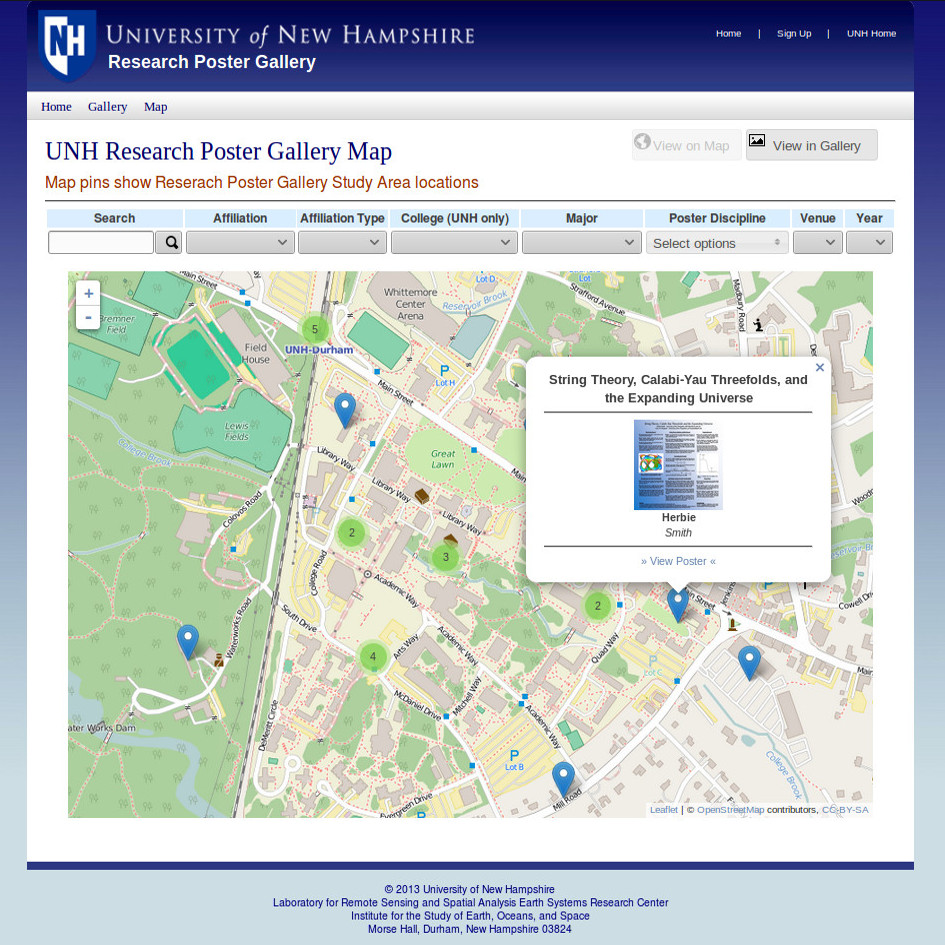
The GSSC is home to the UNH Poster Gallery Archive, funded by the UNH Vice-President's Office for Research. These posters are created and presented by UNH faculty, researchers, and students at national conferences like the annual American Geophysical Union (AGU) conference held in San Francisco, California, and local conferences such as the annual UNH Undergraduate Research Conference (URC) and UNH Graduate Research Conference (GRC).
Click here to find out more about adding your poster(s) to the official UNH Poster Gallery Archive.
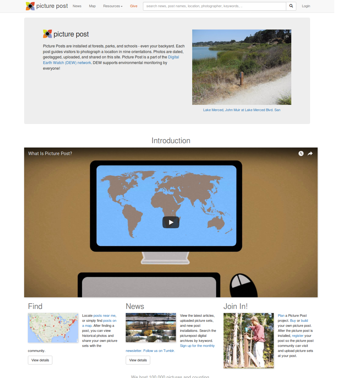
Picture Posts are installed at forests, parks, and schools -- even your backyard. Each post guides visitors to photograph their location in nine orientations. Photos are dated, geotagged, uploaded, and shared on this site. Picture Post is a part of the Digital Earth Watch (DEW) network. DEW supports environmental monitoring by everyone!
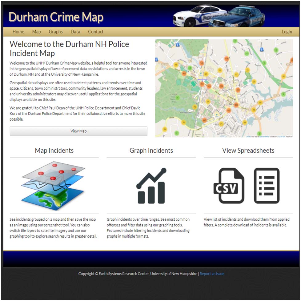
The UNH/ Durham CrimeMap website provides queriable access to law enforcement data about violations and arrests in the town of Durham, NH and at the University of New Hampshire.
Citizens, town administrators, community leaders, law enforcement, students and university administrators may discover to detect patterns and trends over time and space on this site. User tools on the webiste allow for data acess and query in Map, Graph, and Spreadsheet form. Visualizations include feature clustering, heatmaps, overlays, and a movie-like data timeslider tool.
Ask us about how we can implement a web mapping site for your next project of dataset.
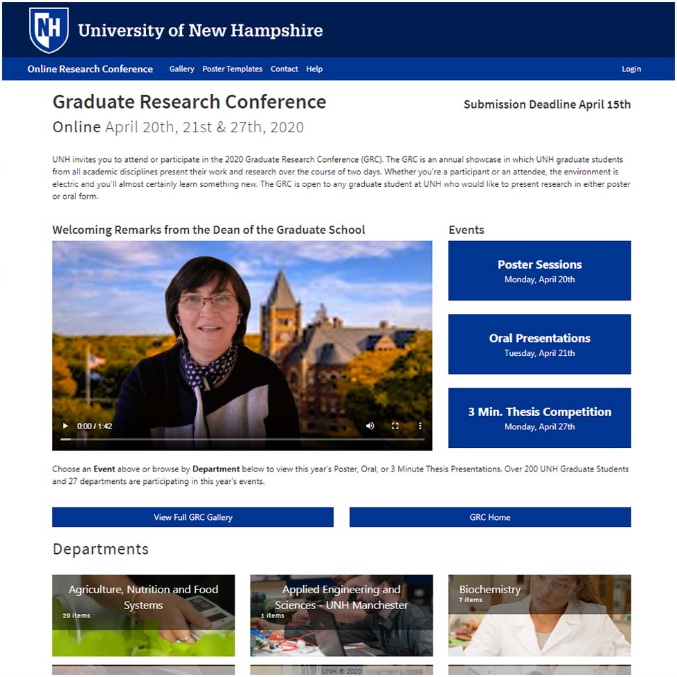
The University of New Hampshire Graduate Research Conference Presentation Gallery is a website interface that showcases over 200 UNH graduate student presentations annually from across 27 academic disciplines at the university. Every year, graduate students present their work and research over the course of two days, including posters, oral presentations, and 3-minute thesis presentations.
The Gallery interface allows for searching, visualization, judging, and view tracking of presentations. Administrative tools allow for the easy management of the website, participants, presentation graphics and metadata.
Ask us about how we can implement a presentation gallery for your next meeting or conference.
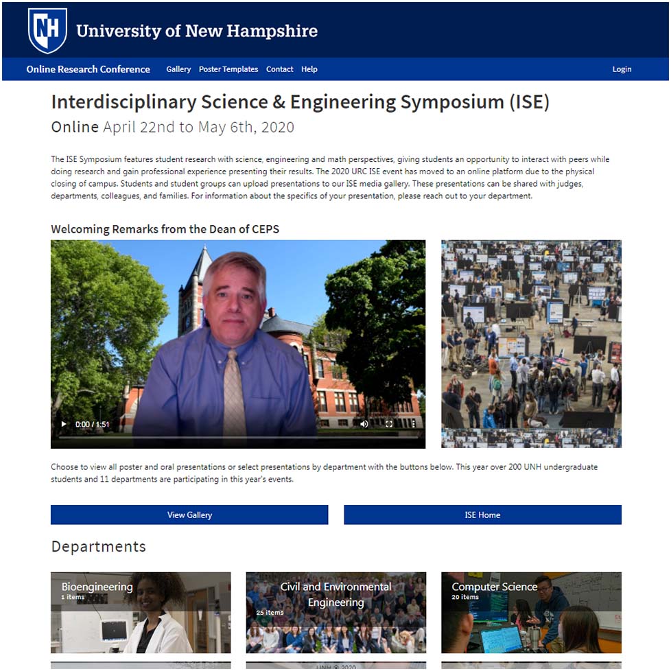
The University of New Hampshire Interdisciplinary Science & Engineering Symposium (ISE) Presentation Gallery is a website interface that showcases over 200 UNH undergraduate student presentations annually from across 11 academic disciplines at the university. Every year undergraduate students present their work and research within science, engineering and math disciplines in poster or oral presentation form.
The Gallery interface allows for searching, visualization, judging, and view tracking of presentations. Administrative tools allow for the easy management of the website, participants, presentation graphics and metadata.
Ask us about how we can implement a presentation gallery for your next meeting or conference.